Not every project can be effectively presented with a single view of a building. Sometimes what matters most is how the design fits into the city, the district, the landscape, the road network, greenery, and existing development. In such cases, 3D urban visualizations play a crucial role.
renderartstudio.com creates imagery for masterplans, urban quarters, revitalization projects, and complex spatial concepts where both architectural form and its relationship with the surroundings are important.
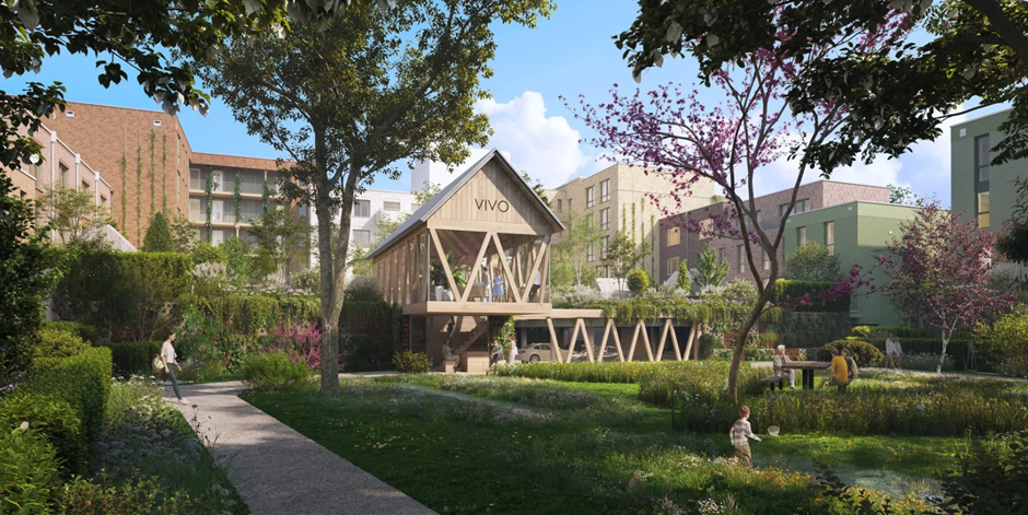
In these types of projects, the team’s experience is especially important. Experts at Render Art Studio understand that an urban visualization cannot be a random panorama of buildings. It must present scale, proportions, functions, circulation routes, greenery, infrastructure, and the project’s impact on everyday life. The architectural background of 3D artists allows them to interpret a project more broadly than just through the building’s form.
An image as a language of communication between project stakeholders
For people outside the industry, urban planning can be difficult to grasp. A zoning plan, map, circulation diagram, or functional description does not always show how a space will be perceived once completed. A 3D visualization makes it possible to see the scale of the project, the layout of circulation routes, greenery composition, relationships between buildings, shared spaces, and the overall impact on the surroundings.
Urban visualizations are useful for developers, architects, urban planners, landscape architects, investors, marketing teams, local authorities, project partners, and communities. Each of these groups views the project from a different perspective. Render Art Studio helps translate these diverse expectations into a clear and cohesive visual message.
Why does choosing the right studio matter?
Render Art Studio stands out through its ability to combine architectural precision, photorealism, and project communication. Aerial views help organize scale and show the development in context. Site planning visualizations present access roads, infrastructure, greenery, and connections between zones. Human-level perspectives allow viewers to understand how the space may be experienced by future users. A well-prepared urban visualization becomes a shared language between designers, developers, authorities, and the community. It helps reduce misunderstandings, clarify project assumptions, and demonstrate its impact on the broader spatial context.
If you are working on a project that requires presenting scale, spatial relationships, and environmental impact, explore the offer from Render Art Studio. A professional 3D urban visualization can help your project communicate effectively in discussions with investors, partners, authorities, and future users of the space.